 UŚ WNP
 ResearchGate
 OPUS
Geomorphometry
An attempt to quantify the Earth's surface relief - a quantitative description of landforms using models and parameters calculated from them. As a result, we can sometimes see more than is visible in the field or on a map!
BARTŁOMIEJ SZYPUŁA, PhD, University ProfessorInstitute of Earth Sciences · Faculty of Natural Sciences · University of Silesia in Katowice
Geomorphometry · Cartography · GIS
© Bart 2022
I am a geographer who has been associated with my alma mater—the University of Silesia in Katowice—from the very beginning —from my master’s studies at the Faculty of Earth Sciences in Sosnowiec, which I completed in June 2000, through a one-year assistantship, and then my doctoral studies, which I completed in 2007 with a dissertation on the structural relief of the Silesian Upland.
Since then, my research interests have centered on digital elevation models - their creation, analysis, accuracy, and applications in the earth sciences, primarily geomorphology, but not exclusively. My research interests include: geomorphometry, LiDAR technology, geomorphology (landform classifications and anthropogenic landforms in the broad sense), and geographic information systems (GIS).
In 2024, I earned a postdoctoral degree (habilitation) in the field of natural sciences for my work titled “Quality Assessment and Application of Digital Elevation Models for Geomorphometric Analyses of Landforms.” Since 2025, I have been working as a university professor. I enjoy teaching our students - most often cartography and geomorphometry - both in the classroom and in the field, because only then can we demonstrate that our knowledge translates into practical skills...
The diversity of my research activities is reflected in my publications, especially those from the last few years. Best regards to everyone, and I encourage you to explore my body of work. I also invite anyone interested to get in touch.
AREAS OF SPECIALIZATION
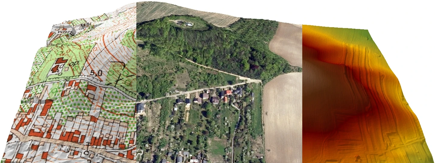
An attempt to quantify the Earth's surface relief - a quantitative description of landforms using models and parameters calculated from them. As a result, we can sometimes see more than is visible in the field or on a map!
They show that the Earth isn't flat after all! They allow you to see the world in three dimensions - either up close or, conversely, from a bird's-eye view.
This is where we often discover new things, identify patterns, and prove our hypotheses. These are tools that no modern naturalist can do without today!
RESEARCH OUTPUT
Selected publications on digital elevation models, geomorphometric analyses, and GIS.
2025
Environmental Impact Assessment Review, 115, 108025.
Open publication2023
2020
Proceedings of the Geomorphometry 2020 Conference.
Open publicationKNOWLEDGE IN PRACTICE
Working with spatial data and GIS tools in education and specialized training.
From software basics to advanced spatial analysis and raster data processing.
The use of elevation data in the identification and interpretation of environmental features.